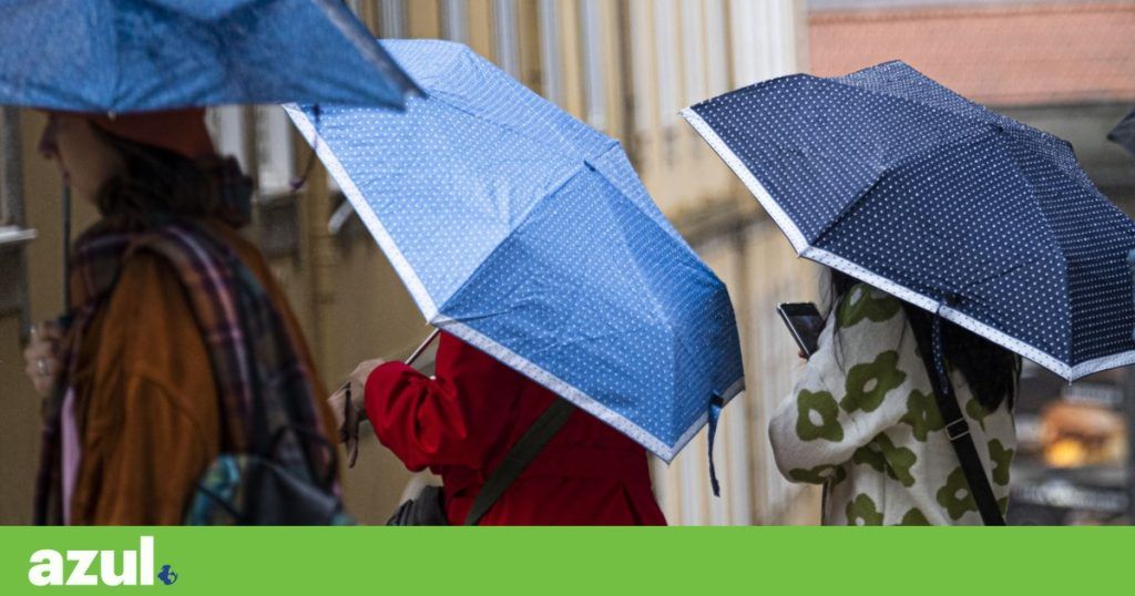
Mainland Portugal recorded 598 incidents due to bad weather and two extreme wind phenomena between 00:00 and 19:00 this Thursday: one in the Tagus basin and the other in Silves (Faro).
In a report made at 7:30 pm, Pedro Araújo, operations officer at the National Emergency and Civil Protection Authority (ANEPC), said that the Greater Lisbon area was the most affected and that among the main events due to bad weather were tree falls ( 263 occurrences), floods (137), falling structures (110) and road cleaning (60).
The occurrences mainly occurred on the North and Central coast, with the most affected sub-regions being Greater Lisbon (197) and Algarve (47), which at the end of the day was being affected by greater precipitation and strong winds, and also Lezíria do Tejo (40). 2,362 operations were committed to the field, with the support of 838 vehicles, he added.
According to Pedro Araújo, mainland Portugal recorded two extreme wind phenomena, the first of these, in the Tagus basin, affecting the municipalities of Montijo (Setúbal), Moita (Setúbal) and generating precipitation on the north bank of the Tagus, in the Lisbon area. , being responsible for around 200 occurrences.
This phenomenon is being analyzed by the Portuguese Institute of the Sea and Atmosphere (IPMA) as it could technically constitute a tornado, highlighted the ANEPC commander.
A possible tornado
Meteorologist Alessandro Marraccini had told Lusa that “at around 2pm, a convective cell that was part of the frontal system that crossed the Portuguese coast in the afternoon, showed quite vigorous activity and crossed the southern region of Lisbon”.
“Shortly afterwards, testimonies of extreme phenomena of the event began to reach us, especially photographs, where there appeared to be a cloud, a funnel-shaped cloud, but which did not appear to reach the Tagus River”, explained the meteorologist.
Although he does not guarantee that it was actually a tornado, as the IPMA will still evaluate the phenomenon in the coming days, Alessandro Marraccini admitted that, based on the information available, the phenomenon witnessed “would indeed have been a tornado”.
https://twitter.com/rolederua/status/1773367646886428805
“From the looks of it, it was a phenomenon very similar to a tornado. Most likely it will be a tornado. And I would say, with my opinion as a meteorologist who was on duty today, that it was a tornado”, said Alessandro Marraccini, noting that he still has no information about where the meteorological phenomenon dissipated.
The meteorologist reinforced, however, that this is just his opinion and that the “issue will be studied in great detail in the coming days by IPMA”. “When there is an extreme event of this type, which also has relevant scientific interest, IPMA issues a statement summarizing what happened in detail,” he added.
Also according to Alessandro Marraccini, there are many variables in radar, satellite and even numerical models for evaluation, meaning that it takes a few days to evaluate the meteorological phenomenon in question.
At the end of the day, at 6:20 pm, in the municipality of Silves, district of Faro, another extreme wind phenomenon was recorded, which caused “large trees to fall, vehicles affected and the roofs of houses affected”, revealed Pedro Araújo.
“Damage surveys are being carried out by fire departments”, added the ANEPC commander, remembering the classification of this phenomenon from a technical point of view is up to IPMA, as meteorological authority. Until now, Civil Protection had no record of any victims associated with these phenomena.
You storm effects Nelson, which is attacking the continent, were also felt on the islands. On the Azorean island of Terceira something unusual even happened: it snowed. Dozens of images were shared on social media this Thursday, most of them captured in Serra de Santa Bárbara, parish of Angra do Heroísmo.
ANTÓNIO ARAÚJO / LUSA
gray easter
Until Easter Sunday, “rainfall will be constant, occurring with more intensity until the end of the day this Thursday”, according to the most recent statement from IPMA.
“This precipitation may be accompanied by thunderstorms and hail, with greater probability on the 29th and 30th. Snowfall is expected in the mountains of the North region and in Serra da Estrela, especially in the highest points of this elevation”, he warned.
The wind will be moderate from the west, sometimes blowing strong and gusty until late afternoon today, with gusts of up to 85 km/h, reaching 100 km/h in the Gerês and Estrela mountains. On the following days, the 29th and 30th, the wind is expected to decrease in intensity, intensifying again on the 31st, with gusts of up to 65 km/h, reaching 75 km/h in the highlands, this institute further detailed.
“The temperature values should not have significant variations until the 31st. Therefore, the minimum temperature values will vary, in general, between 6 and 10°C, being between -1 and 6°C in the interior North and Center . The maximum temperature will fluctuate between 09 and 16°C and be below 10°C in some places in the interior of the Center”, he added.
The IPMA predicts strong sea agitation on the west coast until the 30th, with the most critical period being until the early hours of the 29th, where northwest waves between five and seven meters of significant height are expected, reaching a maximum height of 12 meters.
Tags: Bad weather tornado Lisbon snow Terceira incidents Meteorology
--


